Sunday 19th November - Friday 24th November 2023
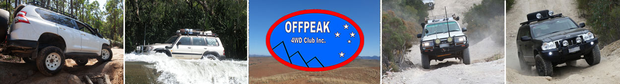
Gathering Coordinator: Gary
It was that time of the year we have all been eagerly awaiting. This year's annual Offpeak Gathering was held near Licola, at Paradise Valley. This proved to be a great location, with grassy flats along the Macalister River. Most attendees arrived on the Sunday afternoon. However, a few keen folks arrived a day earlier. Sunday afternoon was consumed with setting up our camps, chatting amongst friends and then a 5:00pm "happy hour" to learn about the planned adventures for the week ahead.

Monday - Huggets Crossing, Ben Cruachan and Mt Hickey
Leader: David H
Participants: J.P. and Trish W, Tony R, Graham V, David and Sue H, Phil and Gill L, Colin and Heather O, Geoff and Peggy C
Leaving Paradise Valley at 9.10, it was cloudy and misty. We drove past Lake Glenmaggie where the mist cleared, then onto Lanigans Road, Horstsmens Rd and then onto gravel at Kennedy Road where we stopped to air down. We stopped briefly at Huggetts Lookout where the cloud came in and impeded any hope of taking in a view.
We continued on to Huggetts Crossing where we stopped for morning tea beside the Avon River. There were ample great camping spots nearby.


We then back tracked to Ben Cruachan Track then headed off on the Corner Track. We passed through a gate onto private property for a short distance before we reached the start of the final push up Ben Cruachan Track. Having been advised that there may not be sufficient parking for 8 vehicles at the top of the next 2 kilometres of difficult track, it was decided to take a lunch break and reconsider our options.
After lunch the first 4 cars in the convoy set off towards the top of Ben Cruachan, elevation of 836m. On their safe return, the last 4 vehicles repeated the rocky 2 km track to the top. To say the view was disappointing is an understatement as the cloud and fog made visibility nearly impossible. And Yes, there was not much room for even 4 vehicles at the top.


Once the full convoy had regrouped at the lunch spot we then headed off to Dolodrook Track which was a steep climb up towards a ridge line along Hickeys Creek East track. Gradually the atmosphere cleared and we were rewarded with glimpses of views across the High Country. Our descent down towards Licola Road was swift, over freshly graded track.


We returned to Paradise Valley about 4.30 after a very enjoyable and at times, challenging day out on the tracks. Thanks to David H for his wonderful leadership.
Text: Gill L
Photos: Gill L
Monday - Holey Plains
Leader: Gary
Tuesday - Mt Margaret
Leader: Graham V
Participants: Roger, Richard and Maria, Paul and Tineke, Mark and Felicity, Bill and Gill, David and Sue, Uwe, Gary and David
The day started with the wandering, wayward(?) wombats! A pair had decided to take up residence on the banks of the Macalister River. What better place could there be to start a family?

A 9 a.m. start saw us heading north below an overcast sky towards Licola, following the Macalister River, through cattle country along the winding road edged by flowering hollyhocks. We turned up the Tamboritha Road for 13km to Blackfish campground where we aired down and enjoyed morning tea.
Right from the start of the Mt Margaret track low range was required, as we climbed from 290m to 1000m mostly on a hard rock surface. Some sections were quite steep and one of our party disappeared in a cloud of dust as their wheels spun without any progress. It was evident that 4WD was not engaged. Eventually after advice from others and reference to the car manual, nothing would explain why 4WD was not engaged. So, in frustration, the ignition was turned off and engine restarted and away they went with all wheels being driven! A stop at the Mt Margaret Lookout was rewarded with views all around, as the cloud cover was high enough.

As we proceeded south, mostly following the ridge top, another member took drastic action to have an early lunch – they blew a tyre! It may have been good timing as not long after when we were moving again it started to rain, then hail. A couple of mud holes proved no challenge, but soon the track became a little slippery as we descended and the water ran down the shallow wheel ruts.

Our next challenge was a steep climb out of a small creek up the deeply rutted track which had been partially filled with logs. It called for some analysis of how to get the 10 cars through. Eventually it was decided to winch the first car up after filling in the ruts with as many Max Trax as we could find. The winching required a relocation of the anchor point before safe arrival on more level ground. The next 4WD was a heavier vehicle and after a few attempts, it was time to review the decision to proceed. By this time the rain had eased off, but the track was still very slippery and over an hour had been spent with just one vehicle over the creek.

We were about half way along the planned track so turning back was the obvious option. The lead vehicle was winched back down the slippery slope and after 6 or 7-point turns, we proceeded back up the slippery track. We were surprised at how much the track had dried out so the return trip was without incident.

At least one learning point was our attempt to advise those back at camp that we were OK but would be arriving later than expected. Phone reception was available at the Mt Margaret Lookout and when we returned to camp the message was that one of our group was missing. None of us had an operating satellite phone or Zoleo, only a PLB (Personal Locator Beacon) which at that stage would have not been appropriate to use.
We travelled 132km at an average speed of 27kph, but 100km was on bitumen. We were away for 9.5 hours but only spent 5 hours driving.
Text: Paul D
Photos: Paul D
Tuesday - Holey Plains
Leader: JP & Trish W
A second trip to the Holey Plains was scheduled to accommodate the members that went on the other trip yesterday.
As yesterday we travelled to Rosedale, we decided on a slightly different route, for morning tea.
Continuing on Rosedale – Willung Rd, we turned left on Rosedale – Stradbroke Rd. Very soon after entering the park we turned right on West Boundary Rd and then Right on Long Ridge Track passing Harriet Swamp Camp Ground to the intersection with Jacks Track.

Turning right we followed Jacks track to South Boundary Rd, then veered right on Merriman Tk until we reached Merriman picnic ground, no tables or toilets, so went back up Merriman to South Boundary Tk where we turned right, we followed this to Pine Tk, crossed over Rosedale – Stradbroke Rd to Holey Hill Tk where we turned right. Lunch was partaken at the Holey Hill camp Ground, tables toilets but no fire tower?


Continuing on Holey Hill Tk, we turned left on Kellys’ Tk, crossed over Chessum Tk and turned right on Plantation Tk (Red Hill Tk), then left onto Honeysuckle Tk all the way back to Rosedale – Stradbroke Rd where we turned right and returned to camp the shorter way. This park has a lot of sand tracks, banksia scrub and pine plantations.


All together a pleasant and easy day in a very different bush setting than the hills behind Glenmaggie. We travelled around 154 Km for the day.
Text: JP
Wednesday - Mt Useful
Leader: Phil & Gill L
Participants: Geoff & Peggy, JP & Trish, Tony, Graham and David
After a short briefing we departed Paradise Valley at 9:35am, turned right at Licola Rd and drove until we reached Cheynes Bridge. The weather in the valley was misty and cool. We made a left turn onto Cheynes Bridge Track which led us up a short but unexpectedly steep, rutted track. When we reached a flat section of the track the convoy stopped to air down. The track continued its steep, rough climb to an altitude of 400m, levelled out through a deeply rutted stretch before climbing further. It was edged by thick flowering bush and young regrowth trees with mature trees behind, which made for very attractive driving. We finally reached an elevation of approximately 900m where we stopped for morning tea at a clearing in the bush. As if on cue the sun came out and the jackets came off.
After morning tea we drove along Black Range Rd which initially descended through more scenic forest, then levelled out for a while before climbing gradually to over 1000m. Eventually we turned right into the wider, shingle-topped Springs Road where we stopped at an historic marker. We walked about 100 metres into the bush to the site where two huts and three stockyards had stood back in the 1860s. It was assumed the owner was of German descent. Nothing remains now of either the huts or the yards.

Springs Road continued its gradual climb to over 1400 metres before we took the track to Mt Useful where we strolled around looking at the fire tower and the rather misty view of the valley below. Jackets on again!


We intended to stop for lunch at nearby Johnson’s hut but were unsuccessful in finding the track that led to it so instead drove further along the road where we found an open space in which to eat lunch. It was decided over lunch that, rather than continuing on unknown roads we should return the way we had come. We stopped briefly at our morning tea spot for advice from our trip leader before descending the steep and bumpy incline of Cheynes Bridge Track.

It was a great trip with a good balance of challenging off-road driving combined with very pleasant driving through some beautiful mountain forest areas.

The trip took 6 hours and we travelled 102 kilometres.
Text: Peggy C
Photos: David H
Wednesday - Walhalla
Leader: Bill & Gill A
Participants: Angela and Ignatius, Felicity and Mark, Heather and Colin
Circuit loop from Paradise Valley Camping Park to Walhalla via Licola Road, Seaton Glenmaggie Road - Old Joe’s Road, McEvoys Track, Binns Road, Cricket Creek Track, Walhalla Road, Rawson Road, Tyers Road, Cowwarr-Walhalla Road, Downings Road, Stoney Creek Road, Seaton Road, Seymours Lane and Licola Road.
GPS Stats for the day:
• Distance Driven: 148.2 km
• Elapsed Time: 6h:40m
• Minimum Altitude: 59m
• Maximum Altitude: 748m
We Left the Camping Park at 9:30am in a wet mist, temperature was 15°C and headed south on the Licola Road turning right onto the Old Joes Road - Seaton Glenmaggie Road through lush farmland until the road seamlessly joined McEvoy’s Track. McEvoys track is a well-maintained gravel road also used for logging operations.
The sun was now shining and we saw lots of butterflies and the trip leaders claimed to have seen a number of wallabies. Wild flowers were visible along the roadsides. We stopped for morning at tea (10:17) at the historic Rome Hotel site – only seeming identified by a marker and information board of the trials and tribulations of the family that built and ran the hotel.
We continued on our way and soon stopped (11:02) at another history marker which lead us to a site a 50m or so off the road. An information board again revealed the trials of another family that tried to run a restaurant in what was then busy gold mining country. Further off the road there is a grave site of some of the folk believed to have been involved with the restaurant.
Once underway we soon slowed at the Cooks Hotel site (and historic marker), but kept on our way as we were hoping to explore Walhalla and have lunch there. We passed Murder’s Hill driving in a combination of forests, logged coups, regrowth coups and areas with many burnt tress – still with burnt leaves in the crowns. We then turned left onto Binns Road (another fine gravel road) before finally turning left (and south) onto the Walhalla Road.
Before reaching Walhalla, we then turned off Walhalla Road onto the Cricket Ground Track arriving at the grounds at 12:06. An interesting narrow well maintained track led to the Cricket Ground which is itself well maintained and possibly occasionally used (I can’t find a fixture – mostly historic games listed). Some internet entries claim that it is on the top of a hill…
After a pleasant stop at the cricket ground, it was discovered when leaving at 12:33 that there is no track from the cricket ground leading down to the town. The ladies in the convoy had decided earlier (with some buyers’ remorse) to take the “walking track” from the cricket ground to the town. It may well be noted that the climb to the cricket ground from the town was strategically used against visiting teams…
Our intention was to have lunch in Walhalla, but now our journey there required us to retrace our way back to Walhalla Road via the Cricket Ground Track. Two steeply descending tracks to Walhalla Road were identified, but in the interests of time and efficiency it was decided not to attempt them. We arrived at Walhalla at 13:05.
Some of the party went to the “Walhalla Witchery Cafe & Magical Wares” establishment and ordered lunch. It seemed that not all spells worked efficiently and some ordered items took a very long time to materialise!! Nonetheless, the food and drinks were of good quality.
We had hoped to explore Walhalla but too soon it was soon time to press on with the return trip to Paradise Valley Camping Park. We left Walhalla heading south at 14:06 following the Rawson – Walhalla – Tyers sealed roads (C461 then C481) before turning eastwards onto the Tyers-Cowwarr Road at 14:32 (after an initial “miss” and U-Turn to get onto the road). Agan this road was a well-maintained gravel road passing through the Boola State Forest. Two dead wombats we seen at the roadside.
The Tyers-Cowwarr road ended at the junction with Toongabbie-Corrwarr and Weir Road. We turned North on Weir Road and drove the short distance into the Weir recreation area for afternoon tea at 15:06
After a pleasant stop (Why do “they” install a fixed table with only 5 fixed seats???) and afternoon tea, we were soon (15:30) on our way back to the Paradise Valley Camping Park. The exit road (Downings Road) took us on a drive over the weir and around the small pond in the Thompson River created by the weir.
Our trip home was all on sealed roads – including Stoney Creek Road, Seaton Road, Seymours Lane and Licola Road until we finally runed off at Gells Road and entered the Camp Park at 16:11.
Many thanks for an interesting day out, Gill & Bill.

Further information relating to the Walhalla Cricket Ground can be found on Wikipedia and ABC News.
Text: Mark
Epilogue
Thursday was the great "Paradise Valley, no Speed Rally". This was a very fun day to test our awareness, attention span and cognitive thinking. Congratulations to Richard and Maria C for winning. Also a special thanks to Gary and Leanne for all their effort in planning and running this event.
Thursday night was our traditional pub meal! This was a great opportunity to skip camp cooking and enjoy the comforts of a sit down meal. We hit up the Tinamba Pub which provided a relaxed atmosphere for a quiet drink and tasty meal.
On behalf of all attendees, we would like to thank Gary and Leanne, all those that assisted in the planning, the trip leaders, photographers and report writers. Another fantastic Offpeak Gathering! David H.