Saturday 8th - Friday 13th October 2023
Leaders: JP and Trish
Participants: Roger, Geoff and Peggy, Ray and Maz, Colin and Heather, Uwe, Mark and Felicity and Tony
On Sunday 8th October, thirteen members in eight vehicles arrived mid-afternoon at the Halls Gap Lakeside Tourist Park. It was a beautiful sunny day for travelling and our hope is that the fine weather will remain for the next four days of our visit. Tomorrow marks the start of our Grampians adventures.
Monday 9th October
At 8.30am, we assembled near the caravan park kiosk. Some of the crew, looking rather bleary eyed were clutching life support coffee from the store. We remembered our trip briefly from the previous afternoon. It was “turn left” so we did. This led us to Redman Road and following this track we crossed the Mt William Range. We came to a halt soon after when TC had a problem with a noisy wheel. With the help of a screwdriver and some friends a stone was removed and we headed off on our way through tall and dense eucalypt forest. We headed north and left the forest behind as we travelled through farming country where sheep and cattle grazed and some crops had been planted.
Our first stop was at Bunjils Cave to view the rock art. There was opportunity for the energetic to walk while the relaxed atmosphere gave others a chance to look around and take photos. As we continued on Bunjil Cave Road, we headed north past Lake Fyans. Our leaders tried their hand at mustering sheep as a large herd was on the fenced road with no way out. Eventually the sheep found a gap in the fence and ran through as fast as they could.

Our next stop was Heatherlie Quarry, where some reached the cliff face where sandstone had been quarried for buildings. We were now in more open eucalypt country and there were a variety of wildflowers to be seen and photographed.

We took Ostlers Track which was sandy but not difficult to drive, then visited another rock art shelter, Gulgura, near Hollow Mountain.

We headed south on Mt Zero Rd and came to a sign which read “Copper Mine Track” 4wd and it was a series of dips and ridges. It would have been ‘really interesting’ in the wet, but on this lovely sunny day it provided a bit of a roller-coaster ride. One rocky stretch shook us up a bit and as we progressed we got good views. Back on Mt Zero Road, we headed back to camp. Out campsites were on Cockatoo Avenue and as we drove in about 50 cockies arrived to greet us. It was time for Happy Hour and an evening chat around the fire. We had travelled 148 kms on good tracks. Some dust, but no major problem. A very enjoyable trip.
Tuesday 10th October
On a crispy but sunny 5 deg C morning our group met opposite the caravan park. After a short delay for radio check we departed at 8.43am, heading for Halls Gap. Turning left at Mt Victory Road, we met a pair of “hopping leaders”, who attempted to take charge, but soon abandoned the job. We observed spectacular views back down the valley. Turning left into Glenelg River Rd., we stopped to deflate tyres. Now off the blacktop a steep descent took us down a narrow winding road. Much of the area had suffered fire damage, bracken fern was very prominent in the re-growth. Turning right onto Lodge Road then left onto Syphon Road we headed towards Goat Track. This low-lying sandy area is subject to flooding. A quick photo stop at the Glenelg River, then further along another photo opportunity saw magnificent mountain backdrop topped with light grey stratus cloud. Unfortunately Goat Track was closed so a morning tea stop was scheduled. Doing a U-turn we retraced our tracks past Victoria Valley airfield, used in fire suppression. Travelling via Lodge then Red Rock Road, we turned into Harrops Road. Meeting a Parks Vic person, our Trip Leader was advised that many tracks were closed due to pest reduction shooting. So far we had travelled on black top, gravel, metal and sand tracks, all easy going.

We made our way to Glenelg River Road and stopped to take in and photograph the stunning view of the Southern Grampians. Very soon after we came to Strachans campsite, an ample lunch site with picnic tables and amenities. After lunch, a diversion to Moora Moora Reservoir, and a short stroll allowed us to view this lovely waterway with mountain backdrop. A group photo was taken. Henham Road took us to Red Gum Walk – a forest of swamp gums, scent-barks and red river gums, all affected by the 2006 bushfire, which burnt 48% of the National Park. Some of the destroyed gums over 300 years old. We returned to Halls Gap via Lodge, Stony Creek and Silverband roads. Back at camp 3.52 pm, after 151.7 kms, and now 21 deg.

Wednesday 11th October
As we’d had two full-day trips on Monday and Tuesday and were booked in for dinner at the pub, it was decided by popular vote to have a shorter, morning trip only today. It was a cool but sunny morning (with a high of 26 deg. predicted) as we headed towards Dunkeld, past the high rock wall of Lake Bellfield and left onto the Grampians Tourist Road. The drive south took us past some impressive views of the Grampians Ranges, including Mt Abrupt, and we stopped once en-route to take photos. We turned left off the main road into the township of Dunkeld – famous for its gourmet pub meals and “Australia’s Best Tasting Tap Water”. Having anticipated indulging in vanilla slices or similar delights for morning tea, we were sorely disappointed to discover that the Old Bakery was closed. However, after asking for directions from a local dog walker, we made our way to the main part of town where the group went their separate ways in search of food and beverages, or wander around the township and view the famous pub before reassembling after 45 minutes. Uwe did manage to find a vanilla slice but issued a ‘don’t bother’ rating!

Leaving Dunkeld we turned left onto the Victoria Valley Road which led us through a very attractive pastoral area, surrounded by the rugged hills of the Grampians Ranges. We stopped briefly at the Mirranatwa Gap lookout, however unfortunately the trees blocked any view that was to be had. No real photo opportunities there! From there we drove back to camp for lunch followed by birthday cake, the trip being 131 kms. HAPPY BIRTHDAY COLIN!

Thursday 12th October
After a hot night we woke to refreshing light rain this morning. The group met at 8.30am and after a brief roll-call departed at 8.37am. We turned left onto the Grampians Tourist Road alongside Lake Bellfield for several kilometres before turning left again at Redman Track. We intended to turn into Mitchell Road only to find it had been closed – fairly recently apparently, so we continued along Redman until we turned right onto Spears Road, driving through farming country and then back into bushland. When we turned right into Moyston Road, we were amused by the ‘No Beach Access’ sign at the corner. Further along we met the only (small!) water crossing of the trip followed by a length of very bumpy track on the Mt William Picnic Ground track which we’d followed after some discussion, as once more our plans were thwarted by closed tracks. From there we drove along the Moyston-Dunkeld road, past predominantly sheep grazing properties. We then turned right again onto the Yarram Gap Road and the rain, which had held off until then, fell heavily – just in time for morning tea! We waited in our cars at the Wannon Crossing Campground until the rain eased and we were able to get out of our vehicles to have morning tea, a toilet break, and chat (not necessarily in that order!).

After morning tea we headed a very short distance south before turning right towards Mirranatwa Gap and the Henham Track, only to be met by yet another ‘CLOSED’ sign an inconvenient few metres down the track. One by one, we turned around in a private driveway, the only space possible on the very narrow track. After a group chat as to what to do next, we followed the Trip Leader’s suggestion to go back through part of the Victoria Valley, right into Mirranatwa Road and on to the Glenelg River Rd, Rose Creek Rd and up to Mackenzie Falls. We were grateful to find the only shelter at the falls area (well spotted Uwe!) in which to have lunch, as it was very cold and the heavens had opened shortly after we arrived. Rather than walking in the rain to see the falls, we opted to drive to a viewing point on the main road which took a bit of finding.
Our return to the Caravan Park took us along Victory Road, then away from the blacktop onto Stony Creek Road then back on it again on Silverband Road. One couple stopped to walk to Silverband Falls while the rest of the group headed back to camp.

Despite closed tracks and rain showers we had another enjoyable day’s driving, a distance of 131 kms..
Text:Heather, Maz and Peggy
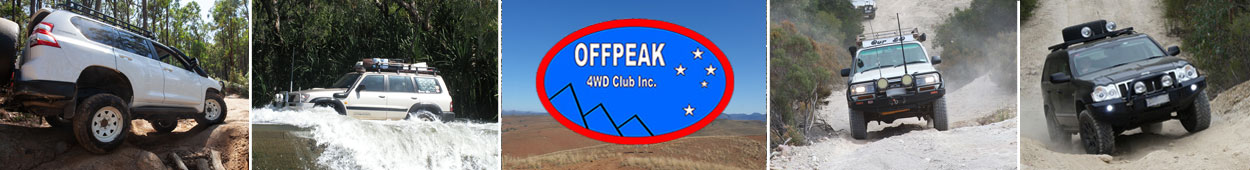
Photos: Mark, JP and Trish